
Climate-related risks and the Heritage Assets of the Kent County area of the UK
Our team, in partnership with the UK’s Kent County Council, developed a value-based quantitative climate risk management framework for the County’s heritage assets. The final report was delivered in September 2025.
Our study is the first of its kind for Europe or the UK. Our methodology was adapted from a process developed by Wang et al for China, though we consider risks posed by two potential climate variables: rising temperatures and increased precipitation, both coastal and inland. Through our approach, we provides a vital template and expandable framework to guide British policymakers as they move to protect cultural assets in a changing environment.
Kent County, UK
Heritage sites, historical markers rich in cultural information, require careful conservation and transmission for the benefit of future generations. In Kent, in the southeast of England, there are today approximately 90,000 such heritage assets. They preserve identity, transfer generational knowledge, provide livelihoods, and sustain ecological processes. These heritage assets were not, however, designed to withstand environmental pressures resulting from long-term climatic disturbances caused by climate change. To prioritize the Kentish assets at risk from a changing climate, and to work towards preserving them, our study developed a value-based quantitative climate risk management framework. Our analysis revealed that by the latter half of the century (2061 – 2080), three environmental pressures – namely, a Radiative Concentration Pathway (RCP) of 8.5, an increase in annual accumulated precipitation of 20%, and a 93% rise in R20 values (days in which precipitation is ≥20mm in a year) – will move over 76,000 monuments in Kent into high and extremely high risk zones resulting from precipitation hazards.
These risk categorizations and their impacts varied across the time scales studied, whether near-term (2021 – 2040) or long-term (2061 – 2080). The number of monuments in the northeast and northwest of Kent (e.g., Margate, Canterbury and Gravesham) that we determined to be at extremely high risk of maximum annual precipitation hazard, moreover, increased by 25% to 25,000 in the long-term projections (2061 – 2080), as compared to near-term projections (2021 – 2040). Our study also observed that, on average, the risk of gradual temperature increased into the future (2061 – 2080), while that of drastic change followed a slight decline for the studied location.
Approximately 41,000 monuments in Kent, thus, were moved from a high risk to a very high-5 risk category of gradual temperature increase by the end of the century. All of this points to a need to adopt robust risk management strategies that can mitigate these climate-related impacts and preserve Kent’s varied heritage assets.
People
Steven Bednarski, Project Director and Primary Investigator
Oluwabamise Afolabi, University of Waterloo
Zihan Zhang, University of Waterloo
Paul Cuming, Kent County Council
Victoria Hosegood, Kent County Council
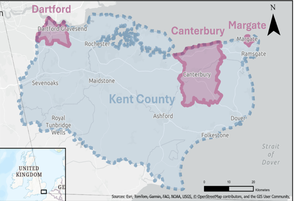
Represents studied area and sampled area. Blue indicates studied area, pink indicates sampled area.
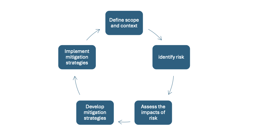
Workflow diagram of study objectives (modified from Paolini et al., 2012)